 |
When adapting the color of individual dots, one assumes that the appearance
of a color only depends on the dot itself.
This is not correct, since its appearance also depends on the possibly inhomogeneous lighting.
Therefore, modeling the inhomogeneities should improve the tracking system.
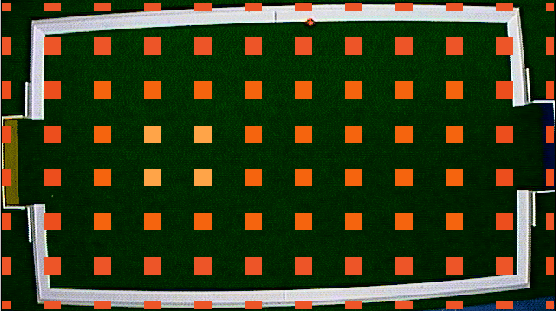
The idea is to maintain for each color a map that models its appearance in dependence of the location on the field.
We assume that the lighting changes slowly with position and use a low-resolution grid (e.g. 12![]() 8).
8).
We initialize these maps uniformly and edit it at extreme positions, e.g. by clicking at a colored marker when it is in a hot spot or in a shadowed region. A map for the orange ball might look like the one shown in Figure 5 after initialization. When the tracking system is running, we adapt the maps automatically every time objects have been found. This approach can cope with slow global changes of the lighting as well as local inhomogeneities that vary slowly in space and time.